Mount Merapi releases 20 lava avalanches as seismic activity continues
Indonesia’s Mount Merapi released 20 lava avalanches towards the Krasak River during a six-hour monitoring period on 18 May 2026, as authorities maintained the volcano at Alert Level III amid continued seismic activity.
- Mount Merapi released 20 lava avalanches towards the Krasak River early on 18 May 2026.
- Indonesian authorities recorded continued seismic activity beneath the volcano during the six-hour observation period.
- BPPTKG maintained Mount Merapi at Alert Level III and warned of pyroclastic flow hazards

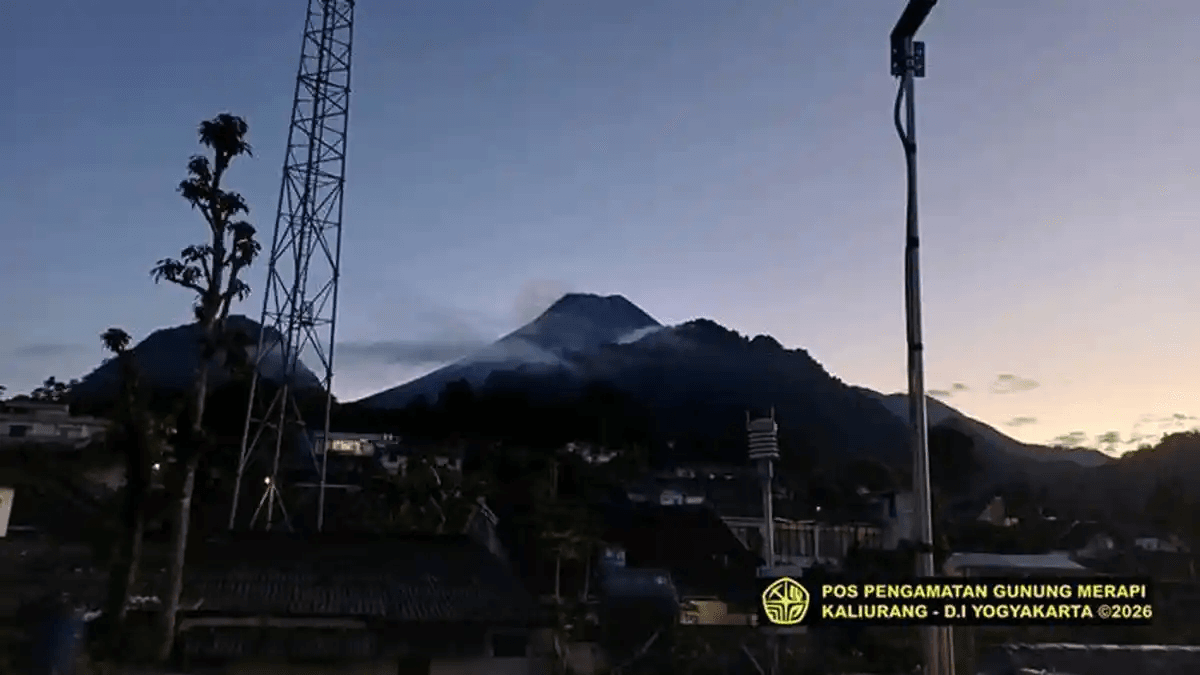
Mount Merapi, one of Indonesia’s most active volcanoes, was observed releasing 20 lava avalanches towards the Krasak River during a six-hour monitoring period early on Monday, according to local media reports citing the Yogyakarta Geological Disaster Technology Research and Development Centre (BPPTKG).
The lava avalanches travelled a maximum distance of 1,800 metres, based on observations conducted between 00:00 and 06:00 Western Indonesian Time (WIB) on 18 May 2026.
BPPTKG also reported continued seismic activity at the volcano, which straddles the border between the Special Region of Yogyakarta and Central Java Province.
During the same observation period, authorities recorded 39 avalanche earthquakes, with amplitudes ranging between 2 mm and 35 mm and durations of 47.88 to 173.82 seconds.
In addition, 11 hybrid or multi-phase earthquakes were detected. These quakes registered amplitudes of 2–23 mm, S-P intervals of 0.5–0.7 seconds, and durations of between 14.6 and 48.11 seconds.
One shallow volcanic earthquake was also recorded, with an amplitude of 80 mm and a duration of 14.15 seconds.
BPPTKG said the volcano remains at Alert Level III, locally referred to as “Siaga”, the third-highest warning level in Indonesia’s four-tier volcanic alert system.
Visual observations indicated that the volcano was clearly visible during the monitoring period. White smoke with light intensity was seen rising approximately 50 metres above the summit crater.
Weather conditions around the mountain were reported as clear, with calm winds blowing eastward. Air temperatures ranged from 17.8 to 19.3 degrees Celsius, while humidity levels were measured at between 87.8 and 88 per cent. Atmospheric pressure ranged from 872.3 to 915.4 mmHg.
BPPTKG warned that current volcanic hazards include lava avalanches and pyroclastic flows in several river channels surrounding the volcano.
In the south-western sector, potentially affected areas include the Boyong River up to a distance of 5 kilometres, as well as the Bedog, Krasak, and Bebeng rivers up to 7 kilometres from the summit.
In the south-eastern sector, hazards could affect the Woro River up to 3 kilometres and the Gendol River up to 5 kilometres.
The agency also stated that volcanic material from a possible explosive eruption could reach areas within a radius of up to 3 kilometres from the summit.
According to BPPTKG, monitoring data indicate that magma supply beneath the volcano remains ongoing, raising the possibility of pyroclastic density currents within designated hazard-prone zones.
Residents and visitors have been advised not to conduct activities within danger zones and to remain alert for potential lahar floods and pyroclastic flows, particularly during periods of rainfall around the volcano.
Authorities added that the alert status of Mount Merapi would be reviewed immediately should there be any significant change in volcanic activity.